Gaza Strip – Areas restricted for Palestinian access – OCHA map Dpi Web-English22016-06-27T18:50:52-04:00 Read More
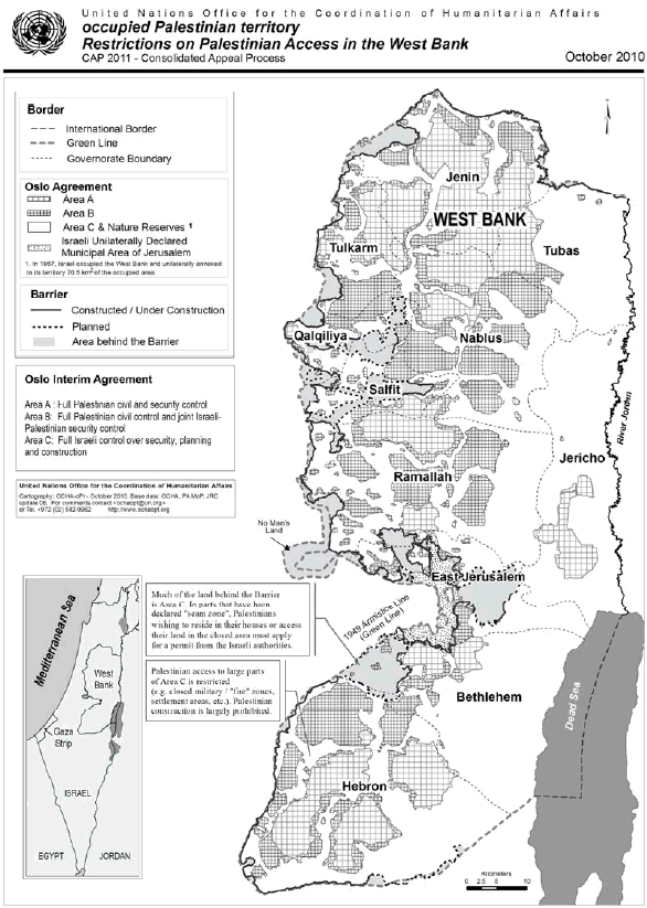
OPT – Restrictions on Palestinian access in the West Bank – OCHA map Dpi Web-English22016-06-27T19:00:22-04:00 Read More
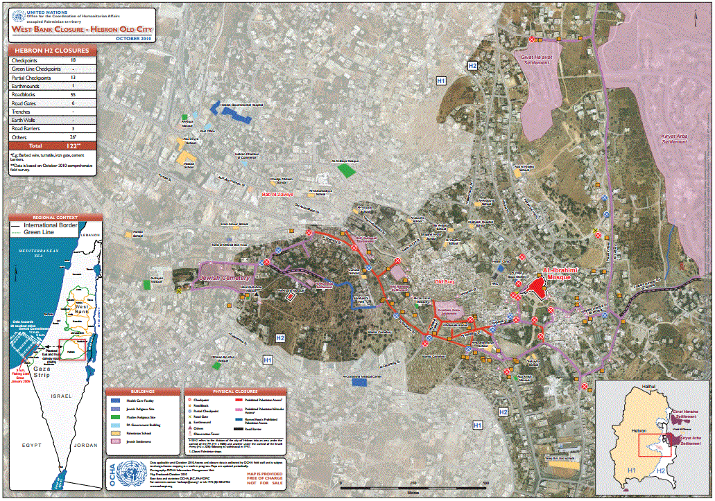
West Bank & Gaza Strip Closure Maps: Access and movement – OCHA map DSU Admin2016-06-27T18:52:46-04:00 Read More
Six years on, separation barrier casts shadow over West Bank life – UNRWA article DSU Admin2019-01-03T12:31:55-05:00 Read More
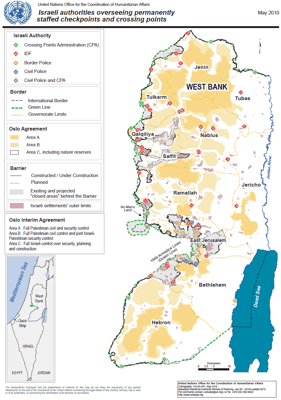
Permanently Staffed Israeli Checkpoints and Crossings in the West Bank — OCHA map (As of May 2010) DSU Admin2016-06-27T20:11:33-04:00 Read More
Palestinian communities vulnerable to settler violence – OCHA map Dpi Web-English22016-06-27T18:56:20-04:00 Read More
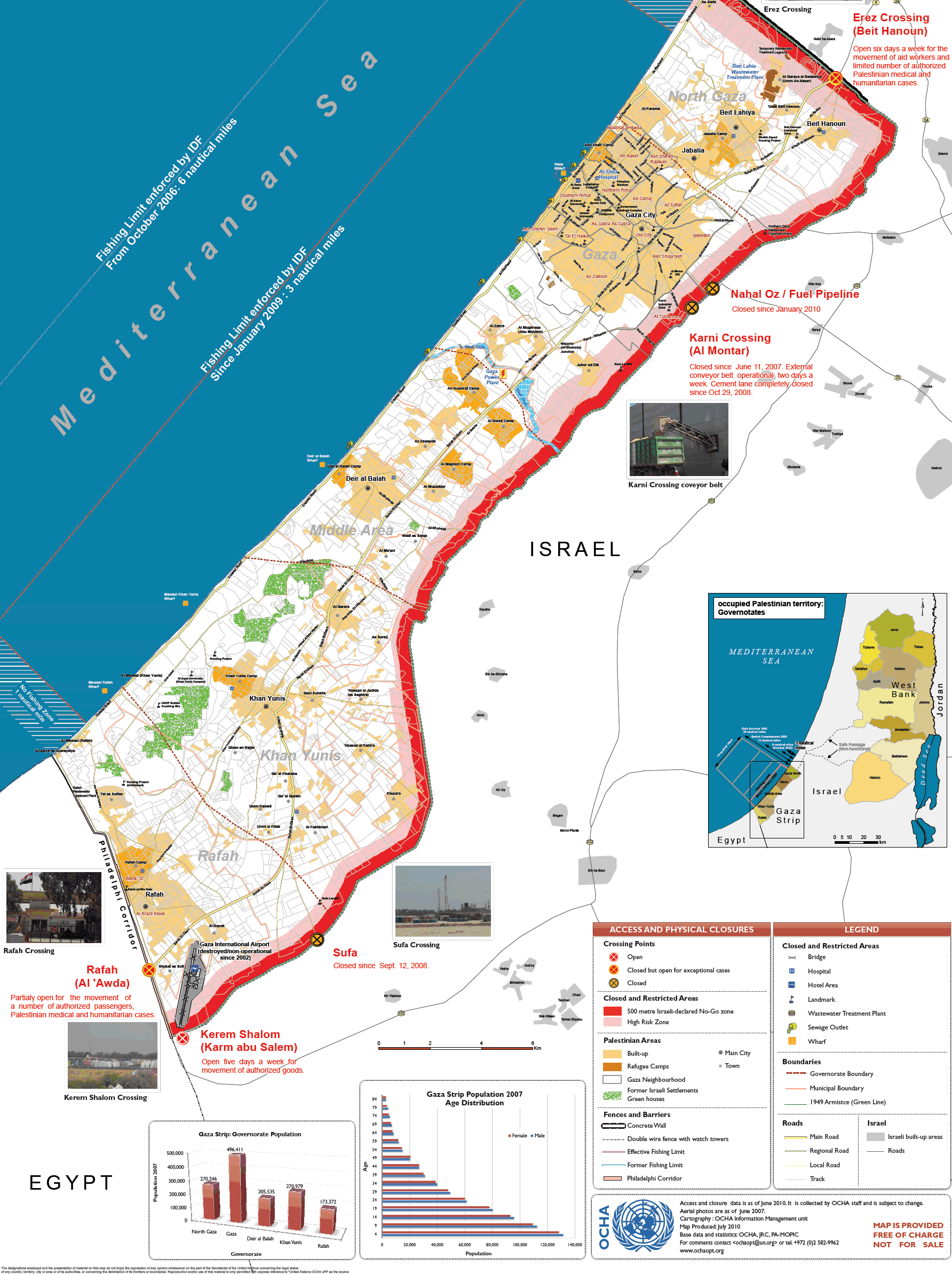
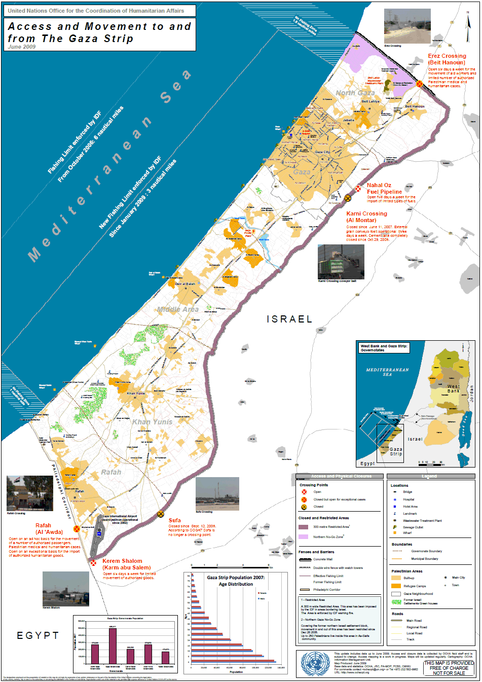
Access and movement to and from the Gaza Strip – OCHA map Dpi Web-English22016-06-27T18:56:48-04:00 Read More