The Dag Hammarskjöld Library has roughly 8000 UN authored maps in its collection.
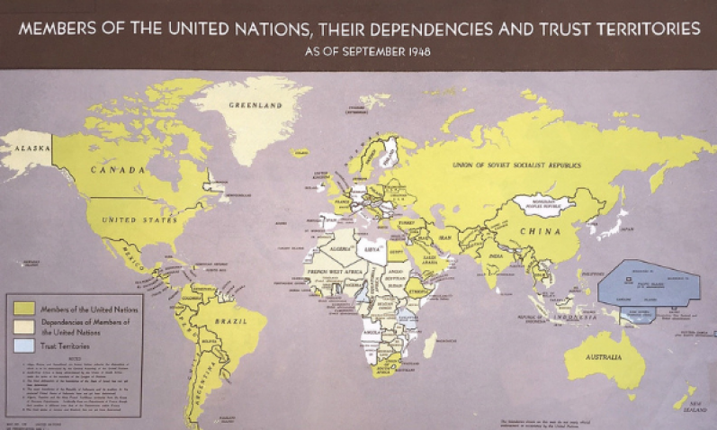
This map collection is unique in its scope, relating to the work of the United Nations through the decades. The collection includes general reference and thematic maps, such as regional and country maps, as well as maps about non-self-governing territories, demographics, and peacekeeping operations. Some rare printed copies are available in the collection, dating back to the earliest years of the United Nations.
To make these striking, one of a kind prints available to the wider public, the Library is carrying out a map digitization project in conjunction with the Geospatial Information Section (GIS) of the United Nations. The project is a unique collaboration between the two departments to unlock and preserve geographic information collected since 1947. In addition to creating digital copies, Library map specialists analyze the map content to create metadata to make each map searchable by subject heading or call number in the United Nations Digital Library.
Maps of Peace Operations
A significant part of the map collection chronicles the deployment of UN peacekeeping and other field missions. These maps give detailed accounts of past and present peacekeeping operations and convey information about important stages as each operation progresses.
Recently digitized maps include those covering peacekeeping operations in the Balkans during the 1990s, the United Nations Mission in Timor-Leste (UNMIT) and the United Nations Mission in Liberia (UNMIL). Since the GIS issued maps several times a year during these missions, there is a rich assortment available today with information on political, national and international boundaries as they have changed over time. One can easily follow the development of a mission from the beginning to its resolution and study border changes, troop deployment, transportation lines, or interim agreements.
Thematic Maps
Thematic maps give insight into specific topics such as water, trade routes and demographics that have concerned the United Nations over the years. An interesting topic covered by UN cartographers is water as a resource. There are digitized maps about groundwater, water resources and desalination on hand - particularly from the desert countries of Africa, where water shortage and quality has been an issue.
Other thematic maps describe trade routes, commodities such as iron and copper, or population changes in different parts of the world.
To browse, view or download the scanned maps, visit the UN Digital Library.
Other digitized series include:
- Yearbook on Human Rights (1946-1988)
- General Assembly: Annotated agenda list (1946-1971)
- Charter of the United Nations (39 languages)
- United Nations Conference on International Organization documents (San Francisco Conference, 22 volumes)
- United Nations Blue Book Series (1994-1996)
- Report of the Commission on the Status of Women (1947-1992)
- Report of UNICEF Executive Board (1946-1993)
- Report of the Governing Council of the United Nations Development Programme (1966-1993)
- UN Statistical Yearbooks (1948-2017)